大臺北全綠地/水體/廣場空間
國際案例
- 蘇格蘭綠色地圖
- http://greenspacescotland.org.uk/scotlands-greenspace-map.aspx
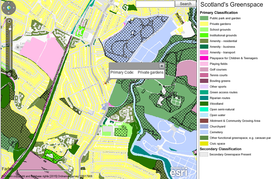
- 綠地定義很廣,分類也很細緻,水體、廣場、兒童遊樂場也會標註,除了資料之外,提供多元的角色情境,例如氣候變遷、市民戶外活動、土地規劃...
- 荷蘭的國家生態綠網工程(National Ecological Network, NEN)
- http://www.government.nl/issues/nature-and-biodiversity/national-ecological-network-nen
- Vegetation Survey in Japan: (shared by Hal Seki)
- (1) 植生調査(1/25,000縮尺)rawdata
- (2) 自然環境調査 Web-GIS
- 近期議題社群的活動:
- 【智庫沙龍-70】串連都市生態綠網 編織永續幸福城市 http://www.tmitrail.org.tw/website/?p=12254(筆記)
- 強調民眾使用經驗回饋的福岡公園議題網站,活気ある公園づくりプロジェクト
台北盆地的資料
以下資料清單蒐集,是否應設立一個協作的資料表單?
雙北市政府開放資料
- 行道樹資料
- 臺北市:北市資料平台...
- 新北市:
- 受保護樹木資料
- 臺北市:北市資料平台...
- 新北市:
- 市民農園
- 社區園圃
- 北市田園銀行
- 建築物屋頂綠化
- 公園
- 北市資料平台臺北市 781 公園經緯度資料
- 開放空間
- 建管處:
- 臺北市 28 河濱公園經緯度資料
- 綠美化空間
- 國產署:網址待補
- 山坡地
- 郊山步道
- http://data.taipei/opendata/datalist/datasetMeta?oid=af84591b-7f3d-4f87-830f-7da5cf384112
- 臺北市親山親水計畫-親山親水廊道系統調查規劃案
- 公有地
相關
- 臺北市山崩潛感圖
- 臺北市環境地質圖
- 水體
- 河川
- 溪流
- 水工構造物
- 歷史水文
- https://www.google.com/maps/d/u/0/viewer?mid=zM_8SIV84gp8.kbWUH6y6sJmE
OSM tag
- natural=tree https://wiki.openstreetmap.org/wiki/Tag:natural%3Dtree
- natural=xxx https://wiki.openstreetmap.org/wiki/Key:natural
- 待補...
OSM Wiki 一些相關的頁面
- Environmental OSM https://wiki.openstreetmap.org/wiki/Environmental_OSM
- Green space access https://wiki.openstreetmap.org/wiki/Green_space_access